For decades, conservationists and wildlife managers understood human wildlife conflict primarily as a land-use problem. Forests shrink, human settlements expand, and animals and people find themselves competing for the same shrinking space. The solution, in this framework, was to protect more land, enforce buffer zones, and manage the boundaries between forests and farms.
This framework was incomplete. What the 2024 Nature Climate Change study — described by its authors as the first systematic global synthesis of climate-driven human-wildlife conflict — revealed is that climate change is now acting as an independent amplifier of conflict, operating through mechanisms that land-use management alone cannot address.
Climate change is a critical yet underappreciated amplifier of human–wildlife conflict, as it exacerbates resource scarcity, alters human and animal behaviors and distributions, and increases human–wildlife encounters. The researchers synthesized evidence of climate-driven conflicts occurring among ten taxonomic orders, on six continents and in all five oceans — confirming that this is not a regional or species-specific problem. It is a planetary one.
The study identified three distinct pathways through which climate change drives conflict — each operating differently, each requiring a different response:
Pathway 1 — Resource Scarcity: When drought reduces water and food availability in natural habitats, both humans and animals are forced to move toward the same remaining resources. A waterhole that dried up last season, a forest that produced no fruit this year, a grassland stripped bare by unseasonable heat — these create pressure that pushes animals toward the one place where food and water are reliably available: agricultural land and human settlements.
Pathway 2 — Behavioral and Range Shifts: As temperatures rise, species shift their ranges toward cooler elevations and latitudes — moving into areas they have not historically occupied, encountering human communities that have no tradition of coexistence with them and no infrastructure to manage the interaction.
Pathway 3 — Increased Encounter Rates: Climate-driven changes in the timing of human and animal activity — earlier harvests, changed migration timing, altered breeding seasons — bring humans and wildlife into contact at times and places that established buffer systems were not designed to manage.
The Drought Data: Every Inch of Rain Lost Costs Lives
The most precisely quantified connection between climate change and human-wildlife conflict comes from a study published in Science Advances in November 2025 by researchers from UCLA and UC Davis — the first study to directly measure how drought intensity affects conflict reporting at scale.
Prolonged decreases in precipitation are associated with increased overall conflict occurrences across taxa and are significantly associated with increased conflict with carnivore species in particular.
The researchers analyzed seven years of data from California’s Wildlife Incident Reporting database — one of the most comprehensive community-derived conflict datasets in the world — and found a relationship so consistent it can be stated as a formula:
For every inch that annual rainfall decreases, scientists found a 2% to 3% increase in reported clashes with a variety of carnivores during drought years.
This is not a California-specific finding. The underlying mechanism — drought reduces prey availability and water access in natural habitats, forcing carnivores into human-dominated landscapes — operates identically in the forests of Madhya Pradesh, the grasslands of Kenya, the hills of Sri Lanka, and every other landscape where large carnivores and rural communities share territory.
In India’s context, this finding carries specific weight. The country’s monsoon patterns are becoming increasingly erratic under climate change — with longer dry periods interspersed between more intense rainfall events. The wildlife conflict data already reflects this pattern. India records nearly 500 human deaths and 100 elephant deaths annually from conflict incidents, according to the WII 2025 Status of Elephants report. In Kerala alone, 103 elephant-related human deaths occurred between 2021 and 2025 — a period marked by exceptional monsoon variability.
The drought-conflict connection explains why conflict incidents in India’s tiger reserves and elephant corridors peak during summer months and in years of below-average monsoon — when animals that normally find adequate food and water in forest interiors are forced to the forest edge, and then beyond it.
How Climate Change Moves Wildlife Into Villages: The 5 Mechanisms
Understanding exactly how climate change physically moves wildlife into human settlements is essential for designing solutions that address causes rather than symptoms.
Mechanism 1: Drying Water Sources
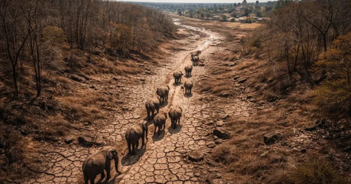
Water is the most fundamental driver of wildlife movement. In natural forest systems, streams, seasonal pools, and wetlands distribute animals across their habitat range. When these water sources dry — as they are doing with increasing frequency across India’s deciduous forests under the combined pressure of higher temperatures and erratic monsoons — animals concentrate near the remaining water.
The remaining water is often in human settlements. Wells, irrigation canals, rice paddies, and village ponds become the last reliable water sources in a landscape that climate change has partially desiccated. An elephant that follows a dry riverbed to a village well is not being aggressive. It is being rational.
Mechanism 2: Fruit and Forage Failure
Forest fruit production is highly sensitive to temperature and rainfall timing. Unseasonable heat during flowering periods can eliminate an entire year’s fruit crop across large forest areas. When the forest offers nothing to eat, frugivorous species — elephants, bears, primates, civets — move to where food is available. Orchards, kitchen gardens, and standing crops become substitute forests.
Mechanism 3: Range Shifts into New Areas
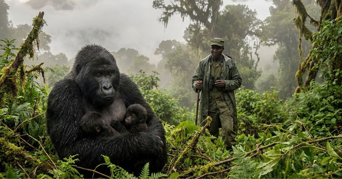
As temperatures rise, species that have historically occupied lower elevations are moving higher — into cooler zones that were previously occupied by different communities of animals and humans. Communities in the Himalayas, the Western Ghats, and the Nilgiris are increasingly reporting encounters with species — leopards, wild dogs, bears — that were historically rare in their areas. These communities have no cultural knowledge, no traditional practices, and no physical infrastructure for managing these new neighbors.
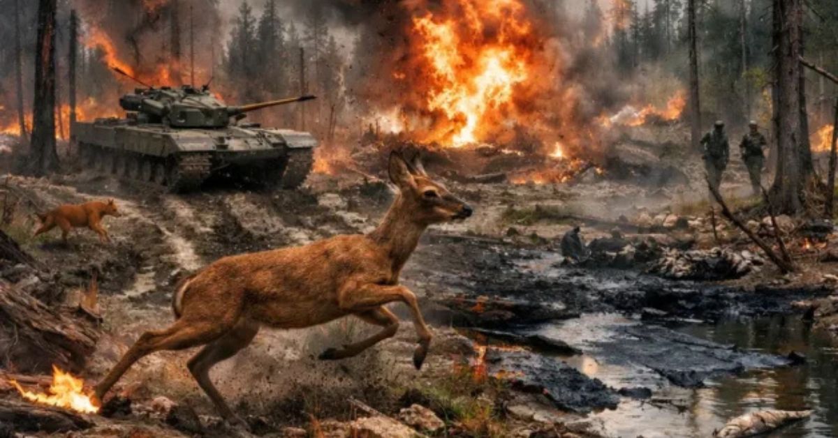
Mechanism 4: Wildfire Displacement
Climate change is increasing both the frequency and intensity of forest fires across India’s tiger and elephant habitats. Fires displace entire animal communities from their home ranges in days — forcing rapid, unplanned movement into adjacent human-dominated landscapes. A tiger displaced by a fire does not choose its new territory carefully. It goes where its movement takes it, which is often a village.
Mechanism 5: Prey Collapse in Disturbed Habitats
When drought or fire degrades the vegetation that supports prey species — deer, wild pig, smaller mammals — carnivores face a compound pressure: less prey in the forest and more accessible livestock just beyond the boundary. The Jim Corbett National Park buffer zone study, published in Springer’s Environmental Monitoring and Assessment in January 2026, documented exactly this pattern over three decades of data from 1991 to 2025 — showing that human-tiger conflict events correlate directly with periods of prey scarcity in the buffer zone.
India’s Response: Wildlife Week 2025 and the “Coexistence” Shift
The scale and urgency of climate-driven human-wildlife conflict is now registering at the highest levels of India’s conservation governance.
Wildlife Week 2025 was themed “Human-Wildlife Coexistence,” keeping in view the incidences of close human-wildlife interfaces over the years and to gather community support so as to enable moving from “conflict to coexistence.”
This is not a symbolic choice of theme. It reflects a fundamental shift in how India’s Ministry of Environment, Forest and Climate Change is framing the problem — moving away from a pure protection model toward an integrated approach that recognizes the lived reality of the hundreds of millions of Indians who share landscapes with large wild animals.
The Union Environment Minister, speaking at the Wildlife Week 2025 event in Dehradun, emphasized the growing need for innovative, technology-driven and community-centric approaches to wildlife management. The event launched five national projects including a dedicated Centre of Excellence for Human-Wildlife Conflict Management (CoE-HWC) at SACON, and a specific program for tigers outside tiger reserves — addressing the reality that an increasing proportion of conflict incidents involve animals operating in unprotected landscapes outside formal reserve boundaries.
The Central Government allocated ₹450 crore for Integrated Development of Wildlife Habitats under its Centrally Sponsored Scheme, with ₹290 crore (an 18% increase over 2024-25 estimates) earmarked for Project Tiger and Project Elephant.
In January 2026, Madhya Pradesh — India’s tiger state — approved a ₹390 crore buffer zone development plan specifically designed to reduce human-wildlife conflict. The plan includes chain-link fencing in sensitive zones, wildlife protection measures, pasture and water source development inside the buffer, fire safety arrangements, and skill enhancement programs for local communities. It is the most comprehensive state-level conflict mitigation investment in India’s recent conservation history.
The Solutions: What Actually Works at the Village Level
The science of human-wildlife conflict mitigation has matured significantly in the past decade. Research from India, Kenya, Sri Lanka, and the United States now points consistently toward a set of approaches that work — not individually, but as layered systems that address multiple conflict pathways simultaneously.
Solution 1: Village-Level Buffer Zone Restrictions — Creating Coexistence Space
The most fundamental structural solution to climate-driven conflict is the establishment of functional buffer zones between wildlife habitat and human settlement — zones that are not simply lines on a map but actively managed landscapes that provide resources to wildlife while limiting the need for animals to enter human-dominated areas.
The principle is direct: if you give animals what they need inside the buffer, they have less reason to cross into the village.
The Madhya Pradesh ₹390 crore plan specifically includes pasture development and water source creation within buffer zones — acknowledging that empty buffers do not work. A buffer zone that offers nothing to eat or drink will not stop a hungry or thirsty animal from moving through it.
Village-level restrictions that evidence supports:
Research from Corbett, Pench, and Bandipur tiger reserves consistently shows that specific human activities in the buffer zone increase conflict risk sharply:
- Night movement in the buffer — most large carnivore incidents occur between dusk and dawn; restricting human movement in the 200-500m transition zone during these hours reduces encounter rates significantly
- Livestock grazing inside the buffer after dark — unsupervised livestock in the buffer are the primary attractant for carnivores; corralling livestock before dusk removes the attractant
- Crop fields extending to the forest edge — fields that reach the forest boundary create an easy food source for herbivores; a 50-100m unplanted buffer strip between the last field and the forest edge creates a transition space that animals are less likely to commit to crossing
Solution 2: Community-Based Early Warning Networks
In one village in Madhya Pradesh, a team installs AI-integrated camera traps to reduce conflict and safeguard lives in a vital wildlife corridor home to 2 million people — and 300 wild tigers.
The technology is available. The challenge is deployment at scale. The most effective early warning systems operating in India’s conflict zones combine three components:
Component A — Camera Trap Network: AI-integrated camera traps at known crossing points on the forest-village boundary. When a large animal triggers the camera, the AI identifies the species within seconds and sends an automatic alert.
Component B — Community WhatsApp Alert: The alert reaches a village coordinator’s phone, who broadcasts to a group containing every farmer and household in the conflict zone. The message includes the animal’s location and direction of movement — giving families 15 to 45 minutes of advance warning to secure livestock, light deterrents, and ensure no one is in the fields.
Component C — Forest Department Integration: The same alert reaches the local forest department patrol team, who can intercept and guide the animal away from high-risk areas before an incident occurs.
The cost of this system — camera traps, smartphones, WhatsApp coordination — is modest relative to the economic losses a single conflict incident can cause a rural family. Wildlife SOS India, operating in conflict zones across Chhattisgarh, Uttarakhand, and Karnataka, has demonstrated that community-based early warning systems reduce conflict incident severity even when they cannot prevent every encounter.
Solution 3: Water and Forage Provisioning Inside Forest Buffers
“Mitigating how much water we take out of natural landscapes could mitigate conflict,” said Kendall Calhoun, lead author of the Science Advances drought-conflict study. “Now that we know how droughts make wildlife interactions worse, why couldn’t we make them better?”
This insight — that restoring water to natural landscapes is simultaneously a drought adaptation strategy and a conflict mitigation strategy — points toward one of the most cost-effective interventions available to forest-edge communities.
Forest departments in Assam and Karnataka have piloted water provisioning programs in buffer zones with documented reductions in elephant incursions during drought years. The mechanism is exactly what the Science Advances research predicted: when natural landscapes offer adequate water, animals have less reason to seek it in human settlements.
Solution 4: Livestock Management — Removing the Attractant
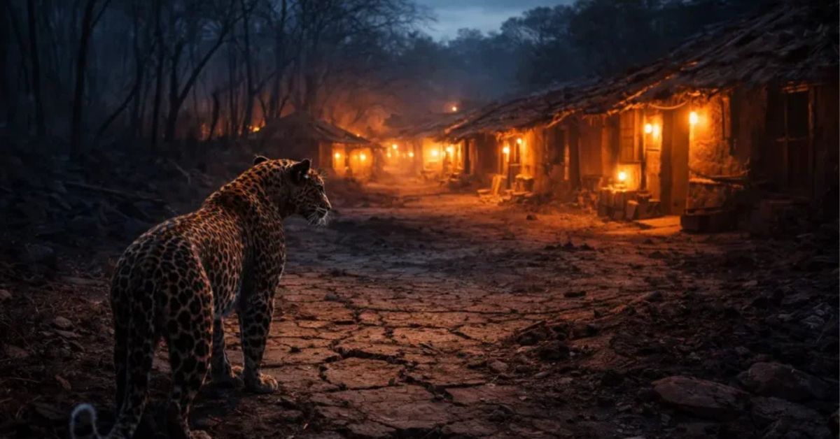
In the context of carnivore conflict — tigers, leopards, dholes, and wolves — the single most effective village-level intervention is secure livestock housing after dark.
The data is unambiguous. Livestock killed outside corrals or in unfenced grazing areas account for the vast majority of carnivore-human conflict incidents in India’s tiger and leopard landscapes. An animal that successfully kills livestock once learns to associate that location with easy food. Return visits become increasingly likely.
Wildlife SOS India’s corral construction program, operating in conflict zones across central India, has documented near-complete elimination of livestock depredation incidents in villages where all households adopted secure overnight corralling — confirming that removing the attractant is more effective than any deterrent applied after an animal has already entered the village.
Solution 5: Village Restriction Zones — The “No-Go” Night Protocol
Perhaps the simplest and most immediately implementable solution at the village level is a community-agreed restriction on human movement in specific zones during high-risk hours.
Most human casualties in human-wildlife conflict occur during night movement — going to the field after dark, walking to collect firewood before dawn, moving between villages along forest-edge paths at dusk. These are not reckless choices. They are the ordinary routines of rural life in areas where electricity is unreliable, agricultural tasks extend through darkness, and the forest edge is simply part of daily geography.
In Uttarakhand’s Van Panchayat system — traditional community forest institutions documented in a 2025 People and Nature study — villages that formalized movement restrictions during known conflict periods showed measurably lower encounter rates than neighboring villages with no protocol, even when forest quality and wildlife density were comparable.
The Data Table: Climate Events and Conflict Spikes
| Climate Event | Wildlife Response | Conflict Type | India Examples |
|---|---|---|---|
| Drought / Low monsoon | Animals move to village water sources | Elephant raids, carnivore livestock kills | Bundelkhand 2023, Vidarbha 2024 |
| Forest fire | Mass displacement from home range | Tiger/leopard in settlements | Uttarakhand fires 2021, 2024 |
| Extreme heat | Behavioral shift to nocturnal activity | Night conflict with carnivores | MP tiger zone summers |
| Fruit crop failure | Bears, elephants seek orchards | Crop raids, property damage | Himalayan foothills annually |
| Flood / Waterlogging | Displaced animals enter higher ground villages | Rhino/elephant displacement | Kaziranga flood years |
| Delayed monsoon | Extended dry season expands conflict window | All species — extended risk period | Rajasthan, Gujarat annually |
What India’s Wildlife Week 2025 Hackathon Found
One of the most significant signals of where India’s conflict management is heading came from the National Hackathon on Human-Wildlife Conflict Co-existence held as part of Wildlife Week 2025 — 120 teams, 420 young innovators, 75 institutions across 20 states, competing to solve the conflict crisis with technology and community design.
The winning solutions clustered around three themes: AI-integrated early warning systems, community-based monitoring networks, and landscape-level corridor restoration. What none of the top teams proposed was purely reactive conflict management — the traditional approach of responding to incidents after they occur.
This shift — from reaction to prevention, from barrier to coexistence, from managing conflict to designing landscapes that reduce its likelihood — is the direction that both research and practice are now pointing.
The climate data makes this urgency clear. If every inch of rainfall reduction increases conflict by 2 to 3 percent, and if India’s already-variable monsoon becomes more erratic with each decade of continued warming, then the conflict baseline will keep rising unless something structural changes in how forests and villages relate to each other.
The buffer zone. The water source inside the forest. The predator-proof corral. The night restriction protocol. The community alert group. These are not theoretical solutions. They are the interventions that communities across India, Africa, and Sri Lanka have tested, refined, and documented as working.
The question is whether they will be deployed at the scale the climate trajectory demands.
Frequently Asked Questions
Q: How exactly does climate change increase human-wildlife conflict?
Climate change amplifies human-wildlife conflict through three main pathways. First, it creates resource scarcity — drought dries water sources and reduces food availability in forests, forcing animals to seek resources in human settlements. Second, it alters species ranges — warming temperatures push animals into new areas where communities have no tradition of coexistence. Third, it increases encounter rates by changing the timing of human and animal activity in ways that established buffer systems were not designed to manage. A 2024 Nature Climate Change study confirmed this across ten animal groups on six continents.
Q: Which animals cause the most conflict in India’s forest-edge villages?
Elephants cause the highest economic damage through crop raiding — over 600 people and 450 elephants die annually across Asia from elephant-related conflict, with most cases in India and Sri Lanka. Leopards cause the highest number of livestock kills in tiger reserve buffer zones. Tigers cause the most fear and the most documented human fatalities in specific corridors including Corbett, Pench, and Sundarbans. Sloth bears cause a disproportionate number of serious injuries relative to their population size. Wild boars and primates cause widespread crop damage with limited serious injury risk.
Q: What is a buffer zone and why does it matter for conflict?
A buffer zone is a managed landscape between protected forest and human settlement. In India, tiger reserves and national parks are legally required to have buffer zones — areas where human activity is permitted but restricted, and where wildlife can move between the core forest and surrounding landscape without entering densely populated areas. Research consistently shows that where buffer zones are functional — with adequate food, water, and cover for wildlife — animals use them as intended and enter village areas less frequently. Where buffer zones are degraded, overused, or dry, animals pass through them without slowing, bringing conflict directly to village boundaries.
Q: Can a village implement conflict solutions without government support?
Several of the most effective interventions require no government funding. A WhatsApp-based community alert group costs nothing. Livestock corralling protocols require only community agreement and basic construction materials. Night movement restrictions require only communication and coordination. Village-level water harvesting structures can be built with community labor. The interventions that require external support are camera trap networks, buffer zone restoration, and compensation systems for livestock losses — but communities that implement the free interventions first often become stronger candidates for government and NGO support programs.
Q: Is human-wildlife conflict getting worse in India specifically?
Yes, by all documented measures. The WII Status of Elephants 2025 report records nearly 500 human and 100 elephant deaths annually from conflict — figures that have been rising steadily over the past decade. Kerala recorded 103 elephant-related human deaths between 2021 and 2025 alone. Tiger and leopard conflict incidents outside protected area boundaries have increased as animal populations recover and corridor habitats fragment. The January 2026 Jim Corbett buffer zone study documented increasing conflict trend lines across 34 years of data from 1991 to 2025. Climate change is confirmed as an amplifying factor in all of these trajectories.